
Weirton ZIP Coverage at a Glance
Official postal evidence supports 26062 as the operational Weirton ZIP. USPS location pages show the main office and Cove station under that five-digit code, while their ZIP+4 endings differ by delivery point. The research did not locate a full official neighborhood-to-ZIP crosswalk, carrier-route export, or list of every ZIP+4 inside city limits. The coverage table therefore stays with verified locations and avoids guessing at neighborhood borders.
| Postal code | Verified Weirton area | USPS facility | What the result means |
|---|---|---|---|
| 26062 | Weirton mailing identity located by official USPS pages | Main Weirton Post Office | Operational city ZIP, not a county or city-limit boundary |
| 26062-9998 | 317 Penco Road | Main Weirton Post Office | ZIP+4 for this delivery point |
| 26062-4500 | 115 Mildren Avenue | Cove station | ZIP+4 for this station, not all of Hollidays Cove |
| 26035-3001 | Nearby Colliers, not Weirton | Colliers Post Office | A nearby Pennsylvania Avenue address with a different postal city |
The contrast with Colliers is useful. Pennsylvania Avenue appears in both local contexts, so a street name without city and full code can send a search to the wrong place. A Weirton ZIP code directory should preserve the street number, city, state, and postal code as one address rather than treating any one field as enough.
Check Weirton ZIP at Penco Road
The USPS Weirton Post Office page identifies 317 Penco Road as Weirton, West Virginia 26062-9998. It lists retail hours of Monday through Friday, 8:30 a.m. to 5:00 p.m., and Saturday, 8:30 a.m. to 1:00 p.m. The listed contacts are 304-723-6795 and the national line at 800-275-8777.
Those details verify the post office, not a household or city border. Use the USPS ZIP Code Lookup for an actual delivery address. Its relevant input fields are simple but must be complete.
| USPS input | How to enter it | Result to save |
|---|---|---|
| Street address | House number, street, suffix, and unit when applicable | Standardized delivery line |
| City | Use the postal city shown for the address | USPS city name |
| State | West Virginia | WV |
| Returned code | Do not shorten the result while taking notes | Five digits plus ZIP+4 when supplied |
The official post-office screen appears below.
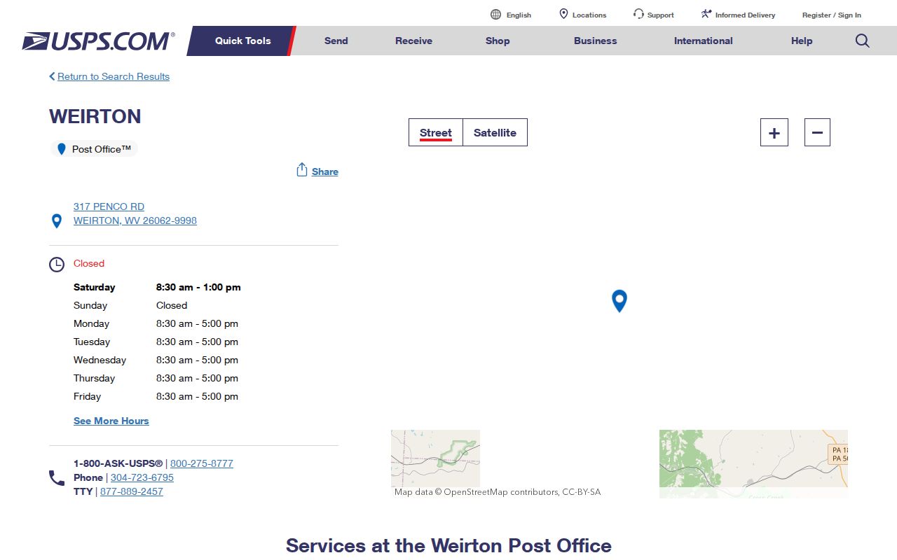
The image grounds the code in a real postal facility while keeping postal service separate from resident, parcel, ward, and county records.
Cove Adds Weirton ZIP+4 Detail
USPS lists Cove station at 115 Mildren Avenue with 26062-4500. The extra four digits narrow mail sorting for that location. They do not mean that Cove is a separate county, nor do they create a legal neighborhood border. Older Weirton research may use Hollidays Cove as a place label because that community helped form the city in 1947, but a historical name and a modern ZIP+4 answer different questions.
This distinction matters when searching obituaries, city directories, deeds, or news. Preserve the place label exactly as the old source prints it, then verify the present mailing address separately. Search aliases such as Hollidays Cove, Weirton Heights, and Marland Heights can help with historical records, while current mail should be checked by full street address through USPS.
Note: A station name is useful search context, but it cannot establish that every nearby street shares that station's ZIP+4.
Find Weirton Residents by ZIP
Official local portals do not offer one public ZIP-wide resident roster. USPS verifies the delivery code. The property viewer and assessor then resolve a parcel from the street address. County deed, court, voter, and other indexes use their own fields and access rules. Follow this order to keep postal geography from being mistaken for proof of residence.
- Enter the full street address, city, and state in the USPS lookup. Save the standardized line and ZIP+4 if one is returned.
- Enter that street address in the West Virginia Property Viewer. Save the county, parcel ID, physical address, and deed book/page.
- Open the Brooke or Hancock assessor based on the parcel's county. Compare the parcel address, owner role, and mailing address without assuming they are the same.
- Use the proper county clerk or other custodian for the exact record sought. ZIP alone is not an accepted substitute for county, parcel, or party fields.
- Record the date of each result because postal, assessor, voter, and map systems update on different schedules.
Once a ZIP search has narrowed to an exact road, the Weirton street directory process explains how address-keyed records fit together. It owns the street-by-street chain; ZIP work should stop at postal verification and geographic routing.
Weirton ZIP Does Not Pick County
The most important local myth is that 26062 means Hancock County. Weirton is incorporated in both Hancock and Brooke counties. Its ZIP covers postal delivery, while county lines control which assessor, clerk, circuit office, magistrate clerk, and election office holds a record. The same five-digit code therefore cannot route every Weirton request.
The official Census Bureau Boundary and Annexation Survey map places Weirton in Brooke County, FIPS 009, and Hancock County, FIPS 029. That map answers an incorporated-place and county question. It does not settle a private boundary or identify an owner. For a specific property, use the exact address in the WV Property Viewer, then confirm the record with the assessor or clerk.
Two-county rule. Treat ZIP 26062 as a postal clue. Use the full Weirton street address and parcel result to choose Brooke or Hancock County.
A no-result from one county is not proof that a property or record is absent. It may simply belong to the other side of the city.
Carry Weirton ZIP Into Parcels
The statewide property viewer accepts county, owner, street address, parcel number, geometry or buffer, and latitude or longitude. Its parcel detail may show one owner at a time, the E-911 physical address, building information, assessment data, parcel history, flood zone, and deed book/page. None of those fields is a ZIP-wide list.
After USPS standardizes the address, paste the street line into the viewer and compare its E-911 address. Then use the county result to open the Hancock Assessor or Brooke Assessor. Both county portals search by parcel address and owner, plus account, district, map and parcel, property type, legal description, and deed book/page. They are not general ZIP filters.
The statewide parcel screen is shown in this official capture.
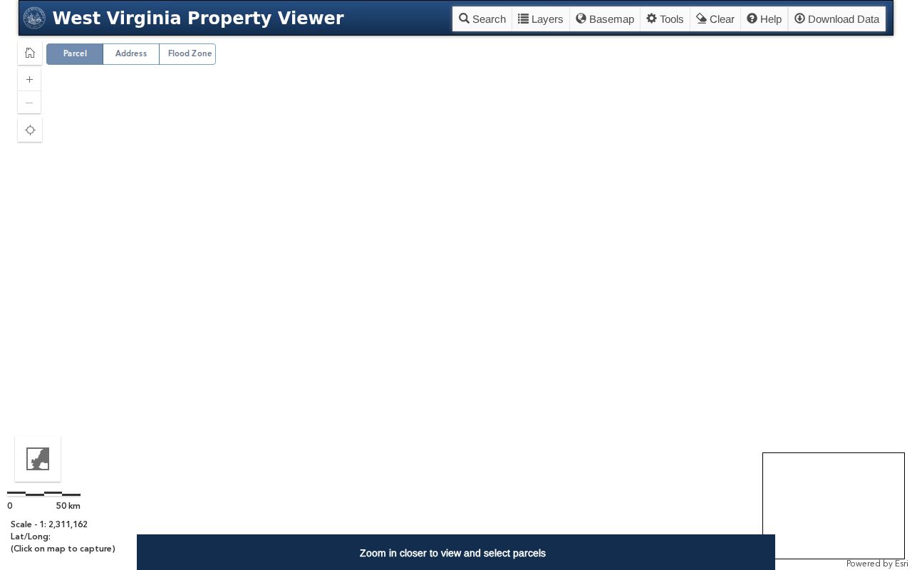
The map helps select a county and parcel. Its displayed boundary lines are low-accuracy aids, not legal boundaries, so a deed, plat, or survey governs legal questions.
Separate Weirton Geographic Layers
A single Weirton address can sit inside several systems that do not share a border. Postal codes guide mail. City limits define municipal jurisdiction. County lines divide public offices. Wards and precincts organize elections. Parcels describe assessed land, and a deed supplies the recorded legal description. Neighborhood names may come from local use or a planning map rather than a law.
| Layer | Official use | Best Weirton source | Do not infer |
|---|---|---|---|
| ZIP and ZIP+4 | Mail routing | USPS address lookup | County, ward, or occupant |
| City boundary | Incorporated-place context | Census BAS map and city sources | Private parcel ownership |
| County | Custodian routing | Property viewer and assessor | That all 26062 addresses share one county |
| Ward or precinct | Election geography | City ward map and county polling sources | Postal delivery zone |
| Parcel | Assessment and land reference | Assessor, GIS, deed and plat | Current household |
The Hancock polling-site list, for example, names Weirton service points on Pennsylvania Avenue, Penco Road, Main Street, Wylie Ridge Road, and Kings Creek Road. Those public locations help orient precinct geography, but they are not resident addresses and cannot define a postal boundary.
Weirton City Limits Versus ZIP
Postal names are built for delivery. Municipal limits can cross the same delivery area, and nearby postal facilities may use a different city name even when a road continues through the region. That is why the Weirton ZIP code directory cannot promise that every use of 26062 lies in the same county or matches a neighborhood map.
The city plan names about 20 neighborhood areas, including Weirton Heights, Marland Heights, Weircrest, Vermont Terrace, Woodland Estates, Sun Valley, and Chateau Village. These are helpful local aliases. They should not be treated as USPS zones, legal parcels, private associations, or fixed ward lines unless a current official source expressly supplies that boundary.
- ZIP code
- A five-digit USPS code used to route mail to a delivery area.
- ZIP+4
- The five-digit code plus four digits that further narrow delivery, often to a segment or point.
- PO-box ZIP
- A code assigned for post-office-box delivery rather than a general street area.
- Unique ZIP
- A code assigned to one high-volume organization or facility.
- Carrier route
- A mail-delivery path that does not serve as a city, county, or parcel boundary.
No official source in the research established a PO-box-only or unique ZIP for Weirton. Those terms explain postal concepts, not local claims.
Save Complete Weirton ZIP Evidence
A reproducible address search needs more than five digits. Save the house number, full street name, direction, suffix, unit, city, state, ZIP, ZIP+4, USPS result date, county, parcel PID, and map source. Keep apartment or unit details private when they are not needed for the record question.
Dates matter. USPS answers a current delivery question. The property viewer is assembled from county data on its own cycle. Assessor and clerk portals may use another update schedule, and the voter lookup says it updates nightly. Record the displayed date or retrieval date rather than presenting mixed systems as one live resident roll.
A five-digit code is a useful first filter, not an identity. The Weirton ZIP code directory works best when postal facts remain postal, parcel facts remain parcel facts, and names are confirmed only through the office that keeps the specific public record.